The core
The peninsula
The old town on the point
See the day toursMap your stop
Brief answer
Punta del Este is in the department of Maldonado on the south-east coast of Uruguay, 1.5 hours from Montevideo, where the river meets the Atlantic.
The location in brief
View 35 stops
Pick a route and tap a pin or a stop: you get its note and a Google Maps link.
The lighthouse has been in service since 1860 and anchors the oldest, most historic part of the peninsula.
Google MapsThe port is a tourist and sports harbour, and the starting point for boats to Isla Gorriti and Isla de Lobos.
Google MapsThe Liga de Fomento on Playa Mansa, stop 1, doubles as a tourist information centre.
Google MapsThe Hand rose on Playa Brava in 1982, at stop 1 of the coast road.
Google MapsIsla Gorriti lies about 2 km from the port and can be visited daily.
Google MapsIsla de Lobos is roughly 8 km off the coast and is a national park for sea lions and fur seals.
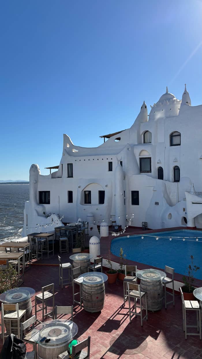
Google MapsCasapueblo, the masterpiece of Carlos Paez Vilaro, sits on the cliffs of Punta Ballena.
Google MapsMaldonado city, the departmental capital, lies inland of the peninsula.
Google MapsLa Barra lies east of the peninsula, one of the districts the resort grew into.
Google MapsThe Jose Ignacio lighthouse is named among the shore points for watching whales.
Google Maps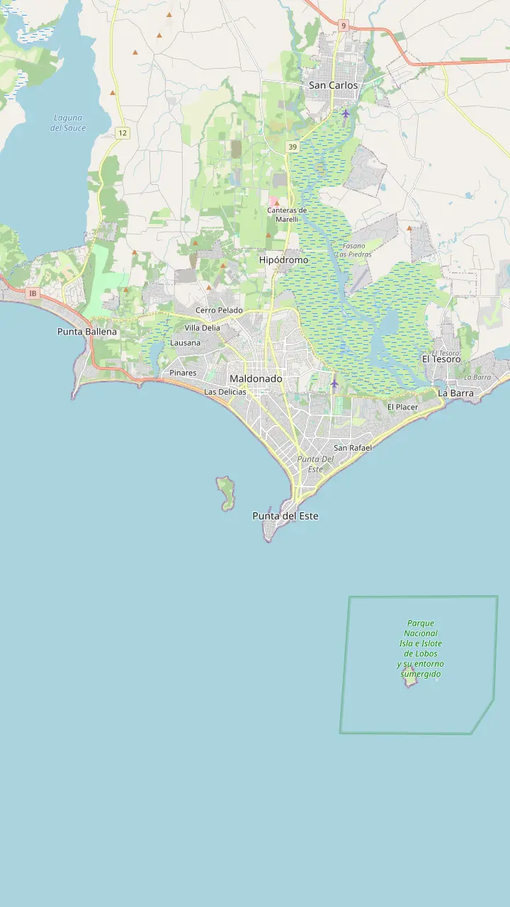
The Hand rose on Playa Brava in 1982, at stop 1 of the coast road.
Google MapsPlaza Artigas hosts a crafts fair of artisans and artists, on Avenida Gorlero between streets 23 and 25.
Google MapsThe port is a tourist and sports harbour, and the starting point for boats to Isla Gorriti and Isla de Lobos.
Google MapsThe lighthouse has been in service since 1860 and anchors the oldest, most historic part of the peninsula.
Google MapsThe Ralli Museum is listed by the Intendencia in the Beverly Hills district.
Google MapsThe Azotea de Haedo cultural centre lists Tuesday to Saturday, 10 to 17 hours.
Google MapsThe undulating bridge that crosses the Arroyo Maldonado to La Barra, a popular photo stop on day tours.
Google MapsCasapueblo, the masterpiece of Carlos Paez Vilaro, sits on the cliffs of Punta Ballena.
Google MapsIsla Gorriti lies about 2 km from the port and can be visited daily.
Google Maps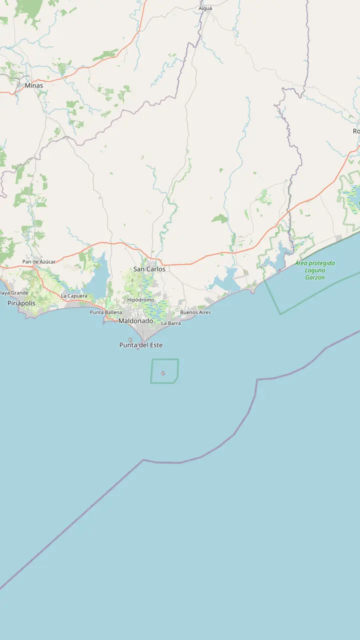
The lighthouse has been in service since 1860 and anchors the oldest, most historic part of the peninsula.
Google MapsThe Liga de Fomento on Playa Mansa, stop 1, doubles as a tourist information centre.
Google MapsThe Hand rose on Playa Brava in 1982, at stop 1 of the coast road.
Google MapsCantegril is one of the oldest residential districts of Punta del Este.
Google MapsPinares is the district that grew around the pine plantings of the early 1900s.
Google MapsPunta Ballena offers a view over the whole bay and some of the best sunsets on the coast.
Google MapsMaldonado city, the departmental capital, lies inland of the peninsula.
Google MapsLa Barra lies east of the peninsula, one of the districts the resort grew into.
Google MapsManantiales lies just east of La Barra on the same coast.
Google MapsThe Jose Ignacio lighthouse is named among the shore points for watching whales.
Google Maps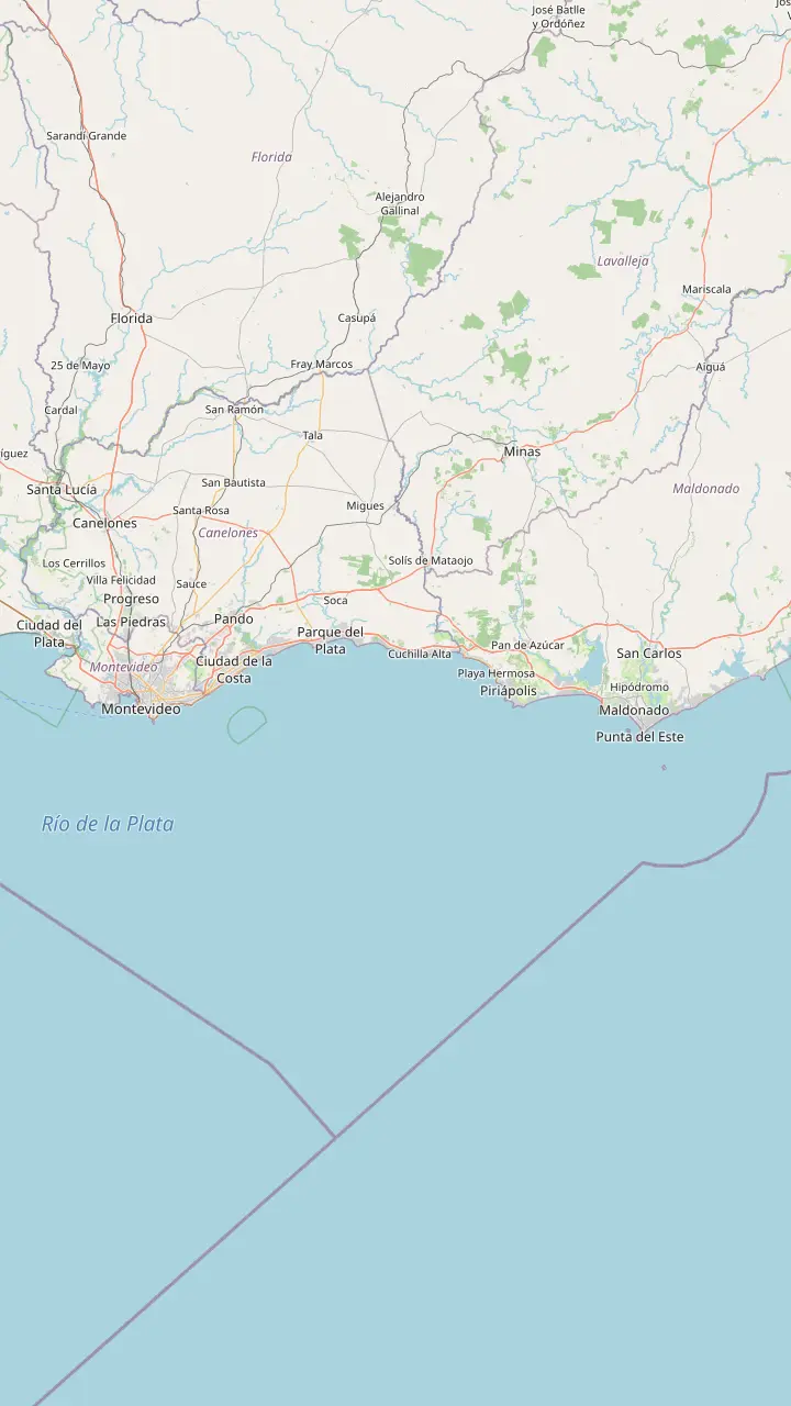
The central bus terminal of Montevideo, where intercity coaches to the east leave.
Google MapsMontevideo's international airport, about 130 km from Maldonado by road.
Google MapsPiriapolis, a resort town on the road between Montevideo and Punta del Este.
Google MapsThe airport of the Maldonado area, west of the peninsula.
Google MapsThe bus terminal of Punta del Este, a short walk from Playa Mansa.
Google MapsThe port is a tourist and sports harbour, and the starting point for boats to Isla Gorriti and Isla de Lobos.
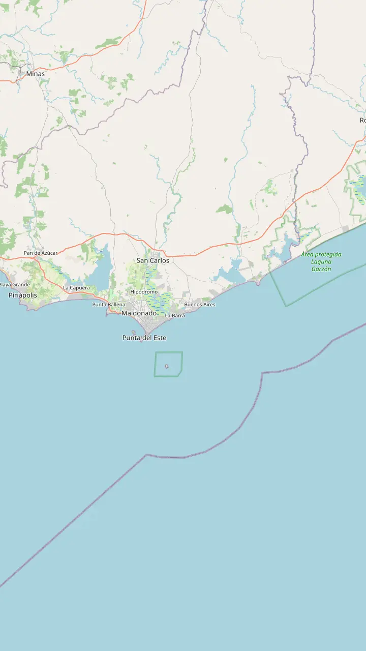
Google MapsMap © OpenStreetMap contributors
A map-first answer to where Punta del Este sits: its department, its two beaches, the islands in front of it and how far it is from the capital.
Editorial team, puntadelestedaytrip.click · Updated November 12, 2026 · Takes 8 min
Facts at a glance
Anyone who asks where is Punta del Este usually wants a clear picture, and the picture is simple. The resort lies on the south-east coast of Uruguay, on a peninsula that points out into the water at the point where the wide estuary of the Rio de la Plata gives way to the open Atlantic. The Intendencia de Maldonado places it at the southern end of the country and counts it among the important resorts of Latin America.1
Administratively the resort belongs to the department of Maldonado. The Ministry of Tourism describes it as lying in that department, 1.5 hours from the national capital,2 while the department's own tourist page puts Maldonado 130 km from Montevideo.3 Both figures describe the same trip, with hours in the ministry's case and kilometers in the department's, and neither depends on which bus company or tour you take.
Facing south and east, the town has water on most sides, which explains why so many of its landmarks are lighthouses, harbors and beaches rather than squares and monuments. On the map you can read the whole place as a thumb of land at the end of a long coastline that runs east toward Jose Ignacio and west toward Piriapolis. Every other place on this page is measured from that thumb.
Place the pins
| Place | Where it lies | How it relates |
|---|---|---|
| Punta del Este peninsula | Department of Maldonado | The old core with the lighthouse14 |
| Playa Mansa | River side | Calm beach on the bay side4 |
| Playa Brava | Ocean side | Surf beach on the Atlantic side4 |
| Isla Gorriti | Offshore | Island with a summer beach cafe15 |
| Isla de Lobos | Offshore | Sea lion island and national park16 |
| Punta Ballena | West | Headland with Casapueblo17 |
| La Barra and Jose Ignacio | East | Districts the resort grew into6 |
Places and notes from the tourism ministry and the Intendencia; positions from OpenStreetMap data.
The honest answer to what is Punta del Este is that the name covers several things together. It is a small town on a peninsula, a seaside resort that grew around that town, and it is the name visitors give to a long stretch of coast that includes beaches, wooded districts and fishing villages. The tourism ministry itself says the resort grew west to form Punta Ballena and east to create La Barra and Jose Ignacio.6
Official numbers show how small the core really is. Uruguay's national statistics institute counts the municipality of Punta del Este at 20,600 people and the locality of the same name at 17,436, in its May 2026 weighted figures.7,8 Those totals are far smaller than the crowds you meet in January, which tells you that the resort is mostly a seasonal place. Both figures refer to residents counted by the census office, not to visitors.
The department around it is changing quickly. The same institute reports that Maldonado grew faster than any other department of Uruguay, mainly because people from elsewhere in the country and from abroad move there.9 Its 2023 census count was 212,954 people, up from 172,130 in 2011.10 When you picture the map, think of a compact old peninsula inside a much larger and busier urban coast.
A common muddle is the relationship between the department, the city of Maldonado and Punta del Este. The department is the large administrative area, Maldonado city is its capital, and Punta del Este is the resort on the peninsula to the south of that city. Visitors ask is Punta del Este in Maldonado because the road signs, buses and listings all use both names, and the answer is yes: the resort lies inside the department.
The Intendencia de Maldonado, the departmental government, publishes a page for each place and groups Punta del Este among them. Its tourist page describes the peninsula as the most historic site of the resort, where the oldest summer residences and the lighthouse stand.14 That tells you the old core is small and walkable, and that most of what you see on a map labelled Maldonado is in fact newer neighborhoods behind it.
For practical purposes you can use both names almost interchangeably when you search a map, but the city of Maldonado is the inland centre of the department, with its own plaza, bus links and everyday shops. If your hotel booking says Maldonado, it may sit several kilometers from the beaches of the peninsula, so check the pin before you pay. The map above shows the city centre inland of the peninsula and the road that ties them together.
Pick your view
Name the question you have and the map gives you the answer.
If I want to know if it is in Maldonado
Yes, the department of Maldonado
The tourism ministry places it in that department.2
If I need the distance from the capital
About 130 km
That is the department's distance by road.3
If I want to see river meet ocean
The Mansa and Brava beaches
The ministry says they mark where the two waters meet.4
If I want a sunset spot nearby
Punta Ballena
The Intendencia says the sunsets there are among the best of anywhere.19
If I want an island visit
Isla Gorriti
It is 2 km from the port and open daily.5
Ways to read the name
The core
The old town on the point
See the day tours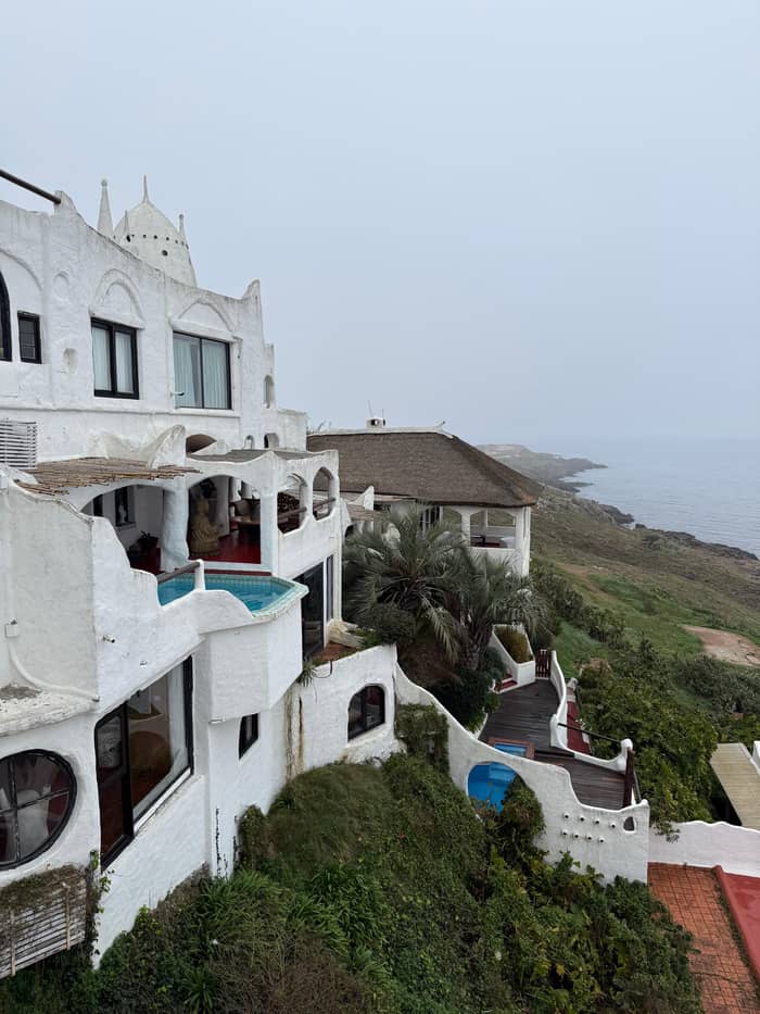
The coast
Beaches and districts
See the day tours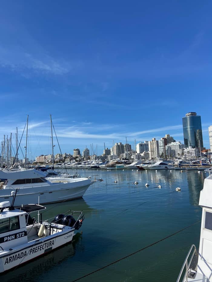
The region
Maldonado as a whole
See the day toursThe peninsula's most quoted geographical fact is also its prettiest. According to the tourism ministry, Mansa and Brava, the famous beaches, sit where the river's long run stops and the ocean coastline begins.4 Mansa faces the bay and the river side, so its water is calmer, while Brava faces the ocean and takes the surf and the wind.
The Intendencia gives the borderline a physical marker. On the Punta de las Salinas, in the small Plazoleta Gran Bretana, stands the anchor of the ship Ajax, which fought in the Battle of the River Plate in 1939.31 The same page says the boundary between river and ocean was fixed in front of that square.32 It is a nice detail to look for on a walk around the Rambla.
Sailors and surfers will tell you the border is not a line in the water, and that is fair, because currents mix and the color shifts with wind and tide. For a visitor the useful point is simpler: on a side of the peninsula you can swim in a gentle bay and on the opposite side you watch ocean rollers break. Both sides are a short walk apart, which is why a morning is enough to see them.
Same map, different day
Pick your party size to see prices for the day tours that reach the peninsula.
Side-by-side: 4 options
Pick your party size to see prices for the day tours that reach the peninsula.
≈
View≈
View≈
View≈
ViewCurrency conversion uses the ECB reference rate on GetYourGuide from-prices. The exact price is displayed when you book.
The map as a day
Montevideo pickup
Guests are collected at one of 36 pickup points in Montevideo.
Coast road
The first break is in Piriapolis, listed at 20 minutes.
Hill view
A photo stop at Cerro San Antonio, listed at 20 minutes.
Cliff top
The Punta Ballena museum stop is listed at 35 minutes.
Peninsula
Punta del Este itself has 2.75 hours of free time and a walk.
Islands belong to the picture too. Isla Gorriti lies about 2 km from the port and can be visited every day, according to the Intendencia, with a cafe on the beach in summer and a wood of pines with paths.5,15 Further out, Isla de Lobos sits about 8 km off the coast facing the ocean beaches,11 and the environment ministry measures 8.1 km from the coast.33
The coastline itself runs a long way. Uruguay's tourism ministry measures the resort's shoreline at more than 20 km, backed by hills that face the sea,12 while the whole department of Maldonado has more than 100 km of coast between Balneario Solis and Jose Ignacio.13 Read the map from west to east and you pass beaches, lagoons and fishing villages before the next big town.
None of these distances is large, which is the key to understanding why a day trip works. A guest can look at the islands from the shore, swim on a calm beach and drive to a lookout on the hills without leaving the immediate surroundings of the peninsula. The page on the Isla de Lobos sea lions on this site covers the island in detail, and the next section covers the headlands to the west and east.
Video
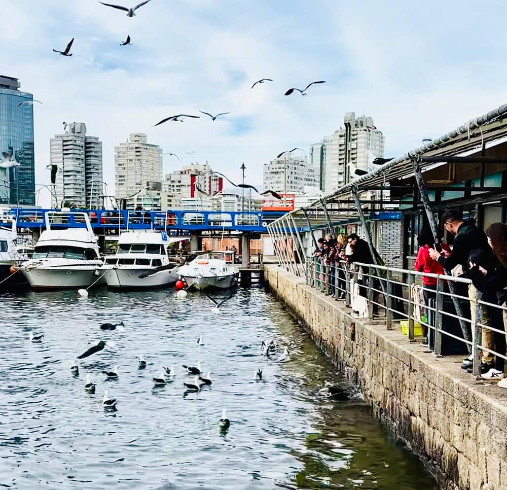
Your World Passport on YouTube · The video waits until you tap play to load.
Gorriti Isle is situated in front of Maldonado Bay. It has a surface of 22 hectares.
Before you pin it
To the west lies Punta Ballena, a headland the Intendencia calls a place where the sunset can be enjoyed as in few spots of the world.19 Casapueblo, the masterpiece of the artist Carlos Paez Vilaro, stands there and the same page calls it among the most emblematic buildings in the country.17 Behind it, the arboretum was planted by Antonio Lussich from 1896.34
To the east lie La Barra and Jose Ignacio, both named by the tourism ministry as districts into which the resort grew.6 The ministry also lists the Jose Ignacio lighthouse among the best places to watch whales from the shore,25 a reminder that the same coast offers nature as well as beaches. On the map, La Barra is the town you reach after crossing the Arroyo Maldonado.
Together the headlands make a simple mental scaffold: Punta Ballena for the art and sunsets, the peninsula for the harbor and lighthouse, and La Barra with Jose Ignacio for the beach villages. Almost every day tour and hotel recommendation uses these anchors, so learning them early makes every later page on this site easier to follow, including the guides to things to do and where to stay.
The listing this site sells starts in the capital, collects guests at 36 pickup points, and drives east along the coast. According to its record the day stops at Piriapolis for 20 minutes, at Cerro San Antonio for 20 minutes, at the Casapueblo museum for 35 minutes and then in Punta del Este, where there is 2.75 hours of free time. On the map that is a long line with Punta Ballena as its last stop before the peninsula.
Use the pins above to follow it. Piriapolis and Cerro San Antonio lie west of the department's centre, Punta Ballena comes next, and the lighthouse, the port and the Hand sculpture sit on the peninsula itself. Add the 130 km between the capital and the department,3 and the drive times in the listing make sense without anyone having to explain them.
If you plan to stay overnight instead of returning the same day, the same map helps you choose. The peninsula suits a visit on foot, Punta Ballena suits a quiet cliff-top evening, and La Barra suits a beach-village base. The page on where to stay in Punta del Este goes through the districts in turn, and the day trip page lays out the hours of the tour in detail.
FAQ
The resort lies on a peninsula south of the city of Maldonado, within the department of the same name.2
The Intendencia puts the department of Maldonado 130 km from the capital; the resort is within it.3
The tourism ministry places them where river and ocean meet.4
The Intendencia puts the island 2 km from the port, and says it can be visited daily.5
The Intendencia counts more than 100 km of beaches from Balneario Solis to Jose Ignacio.13
Sources
Also worth reading
Heading to Punta del Este? Ask a real person here.