On foot
The peninsula
Lighthouse, port, Gorlero
See the toursMap your stop
View 35 stops
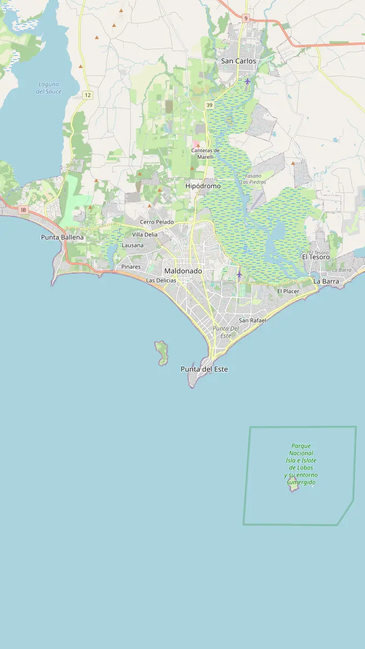
Pick a route and tap a pin or a stop: you get its note and a Google Maps link.
The Hand rose on Playa Brava in 1982, at stop 1 of the coast road.
Google MapsPlaza Artigas hosts a crafts fair of artisans and artists, on Avenida Gorlero between streets 23 and 25.
Google MapsThe port is a tourist and sports harbour, and the starting point for boats to Isla Gorriti and Isla de Lobos.
Google MapsThe lighthouse has been in service since 1860 and anchors the oldest, most historic part of the peninsula.
Google MapsThe Ralli Museum is listed by the Intendencia in the Beverly Hills district.
Google MapsThe Azotea de Haedo cultural centre lists Tuesday to Saturday, 10 to 17 hours.
Google MapsThe undulating bridge that crosses the Arroyo Maldonado to La Barra, a popular photo stop on day tours.
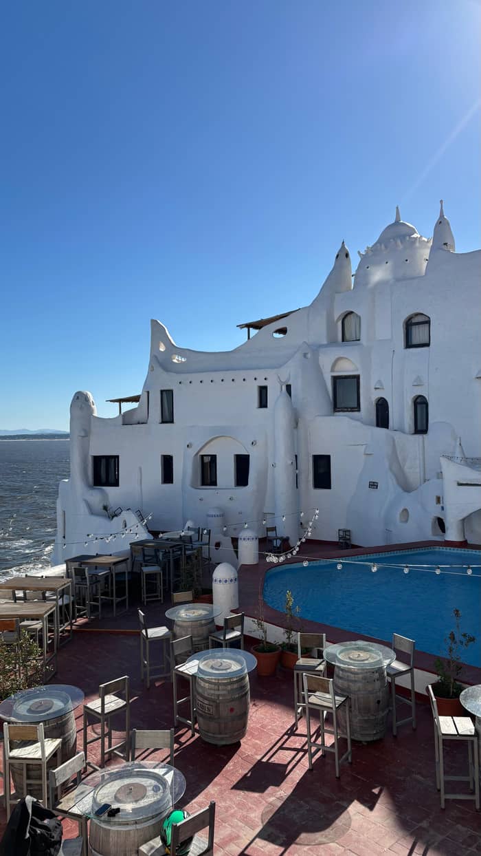
Google MapsCasapueblo, the masterpiece of Carlos Paez Vilaro, sits on the cliffs of Punta Ballena.
Google MapsIsla Gorriti lies about 2 km from the port and can be visited daily.
Google Maps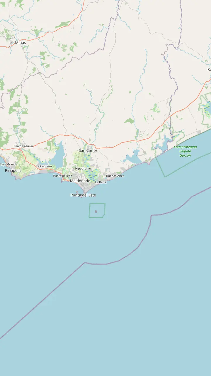
The lighthouse has been in service since 1860 and anchors the oldest, most historic part of the peninsula.
Google MapsThe port is a tourist and sports harbour, and the starting point for boats to Isla Gorriti and Isla de Lobos.
Google MapsThe Liga de Fomento on Playa Mansa, stop 1, doubles as a tourist information centre.
Google MapsThe Hand rose on Playa Brava in 1982, at stop 1 of the coast road.
Google MapsIsla Gorriti lies about 2 km from the port and can be visited daily.
Google MapsIsla de Lobos is roughly 8 km off the coast and is a national park for sea lions and fur seals.
Google MapsCasapueblo, the masterpiece of Carlos Paez Vilaro, sits on the cliffs of Punta Ballena.
Google MapsMaldonado city, the departmental capital, lies inland of the peninsula.
Google MapsLa Barra lies east of the peninsula, one of the districts the resort grew into.
Google MapsThe Jose Ignacio lighthouse is named among the shore points for watching whales.
Google Maps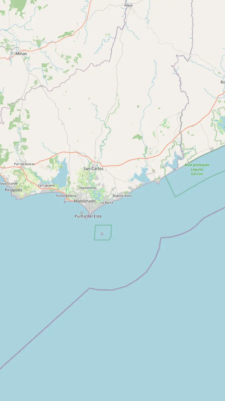
The lighthouse has been in service since 1860 and anchors the oldest, most historic part of the peninsula.
Google MapsThe Liga de Fomento on Playa Mansa, stop 1, doubles as a tourist information centre.
Google MapsThe Hand rose on Playa Brava in 1982, at stop 1 of the coast road.
Google MapsCantegril is one of the oldest residential districts of Punta del Este.
Google MapsPinares is the district that grew around the pine plantings of the early 1900s.
Google MapsPunta Ballena offers a view over the whole bay and some of the best sunsets on the coast.
Google MapsMaldonado city, the departmental capital, lies inland of the peninsula.
Google MapsLa Barra lies east of the peninsula, one of the districts the resort grew into.
Google MapsManantiales lies just east of La Barra on the same coast.
Google MapsThe Jose Ignacio lighthouse is named among the shore points for watching whales.
Google Maps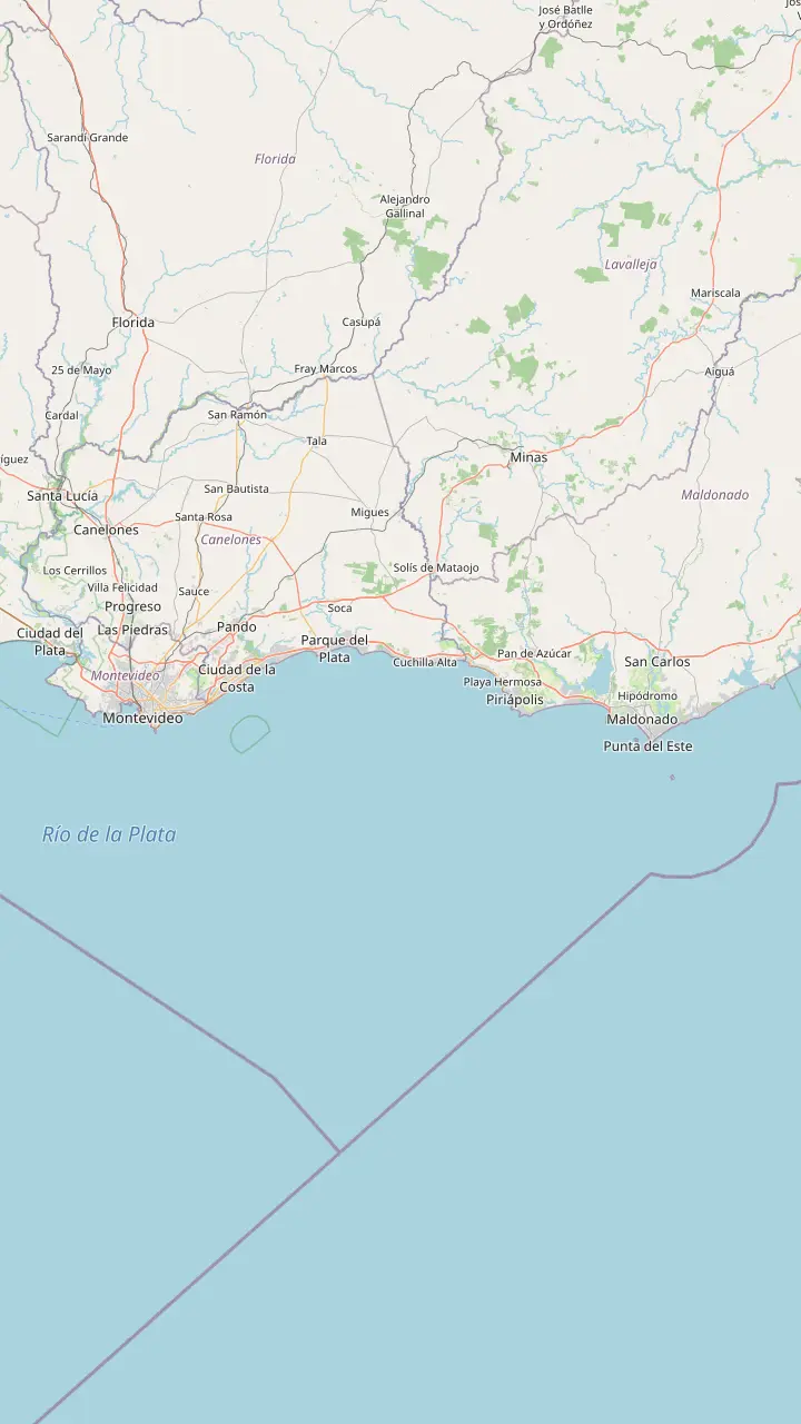
The central bus terminal of Montevideo, where intercity coaches to the east leave.
Google MapsMontevideo's international airport, about 130 km from Maldonado by road.
Google MapsPiriapolis, a resort town on the road between Montevideo and Punta del Este.
Google MapsThe airport of the Maldonado area, west of the peninsula.
Google MapsThe bus terminal of Punta del Este, a short walk from Playa Mansa.
Google MapsThe port is a tourist and sports harbour, and the starting point for boats to Isla Gorriti and Isla de Lobos.
Google MapsMap © OpenStreetMap contributors
The sights of the peninsula and its coast on a map, from the lighthouse and the Hand to Casapueblo and the islands, with a day plan and wet-weather options.
Editorial team, puntadelestedaytrip.click · Updated November 12, 2026 · Takes 7 min
If you ask what Punta del Este is known for, the honest answer is a mixture of things that do not usually share a postcard: a seaside resort with a long list of glamorous holidays behind it, a monumental hand rising out of the sand, a working harbor with sea lions, and a headland where artists built a house on the cliffs. The tourism ministry sums the coast up as a destination for surfing, windsurfing, jet skiing, motorboating, sailing, fishing and yachting.6
Culture is part of the brand as well. The same page names the International Jazz Festival and the International Film Festival among the events the resort hosts, along with exhibitions by contemporary artists.7 You do not need a festival date to enjoy the place, because the sights are outdoors and mostly free to look at: you walk, take photos, swim and watch the water. The paid parts are boat trips, tastings and museum visits, which later sections point out.
On the map above the attractions fall into several groups: the peninsula with its lighthouse, port and avenue; Playa Brava with the Hand and the sculpture promenade; the headland of Punta Ballena to the west; and the islands and coast to the south and east. Read the guide in that order and you will have seen most of what the resort is known for, with time to spare for a long lunch.
Sights compared
| Sight | Area | What to know |
|---|---|---|
| The Hand | Playa Brava, stop 1 | Raised in 19821 |
| Lighthouse | Peninsula | In service since 18602 |
| Port | Peninsula | Tourist and sports harbor9 |
| Plaza Artigas | Gorlero, streets 23 to 25 | Crafts fair16 |
| Azotea de Haedo | Cantegril area | Tuesday to Saturday, 10 to 1720 |
| Casapueblo | Punta Ballena | Masterpiece of Paez Vilaro21 |
| Parque El Jaguel | Maldonado side | Free access all year22 |
Places and notes from the Intendencia de Maldonado; check hours and fees locally before you go.
Start in the old part. The Intendencia treats the lighthouse district as the historic core, with the oldest summer homes in styles of the early last century,12 and the lighthouse itself has been in service since 1860.2 Its leaflet in English adds that it was built by Tomas Libarena, started working on November 17th, 1860 and stands 45 metres high.13,14
From the lighthouse the pedestrian Rambla de Circunvalacion leads you around the peninsula toward the harbor.8 The port is a tourist and sports harbor,9 and the leaflet gives it 400 mooring lines.15 It is also where boats leave for the islands, and where the day tours and the cruise excursions start, so it is a natural next stop.
Avenida Gorlero is the main commercial and dining street, with banks, a casino and slot machines.10 Between streets 23 and 25 Plaza Artigas hosts a crafts fair that gathers artisans and visual artists.16 A few blocks away the shopping street Calle 20 is a walk of 7 blocks, according to the Intendencia.17 A tourist office operates at the Liga de Fomento on Playa Mansa, and the leaflet lists other information points, so you can pick up a map on the way.18,19
How long things take
Durations as the GetYourGuide listings state them; the winery trip is listed at 4.5 to 5 hours, shown here at the upper end.
The sculpture everyone photographs rises from the sand of Playa Brava at stop 1 of the coast road. Its official title is Man Emerging into Life, and the Intendencia says it is also known as La Mano and Los Dedos.28 It went up in 1982 as the outcome of the First International Meeting of Modern Open-Air Sculpture.1
The story of its making is part of the charm. 9 sculptors from different countries took part in the meeting,29 and the Chilean Mario Irarrazabal chose the site and executed the work in 6 days.30 He had to deal with the usual wind of the peninsula while it went up.31 Many years later, in 2019, the Maldonado Heritage Commission declared the Hand a Good of Heritage Interest.32
Around it spreads the Paseo de las Americas, a sculpture promenade created in 1982 through an international competition run by the Intendencia.33 The Intendencia counts the Hand among the most visited places for photographs on Playa Brava,11 so go early or at the end of the day if you want the frame to yourself. The English leaflet also lists a Carrara marble sculpture by Pablo Atchugarry on the walking route, 5 meters tall.34
Pick your sight
Describe your ideal day and a sight comes up.
If I want the classic photo
The Hand on Playa Brava
The Intendencia calls it a favorite for photographs.11
If I want history and views
The lighthouse area
The Intendencia treats it as the historic core.12
If I want a sunset
Punta Ballena
The Intendencia praises the sunsets there.3
If I want art on a wet day
The Ralli Museum
It is listed in the Beverly Hills district.26
If I want nature and the sea
Isla Gorriti or the whales
Compare ways to spend a day
On foot
Lighthouse, port, Gorlero
See the tours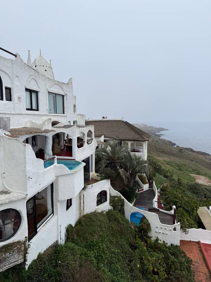
By car
Casapueblo and sunsets
See the tours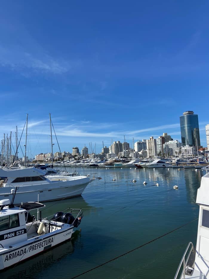
By boat
Gorriti and Lobos
See the toursWest of the peninsula, Punta Ballena is the headland where the light does the work. The Intendencia says the sunset can be enjoyed from there as in few places of the world, and that the panoramic road over the hills gives a view of the whole bay of Maldonado and Portezuelo.3,42 Casapueblo, the masterpiece of Carlos Paez Vilaro, stands on the cliff.21
A visit to Casapueblo is included as a stop on the site's day tour, where the itinerary lists the Casapueblo museum for 35 minutes. Another full-day listing gives a stop of 30 minutes there. Museum hours and ticket prices can change with the season, and the listings for the cruise excursions state that entry is not included, so confirm on the museum's own site that day.
Close by, the arboretum planted by Antonio Lussich from 1896 is a calm green alternative to the busy beaches.23 If you reach Punta Ballena by car, plan the visit for late afternoon, then linger for the sun going down. Visitors who come on a day tour usually see it with the rest of the group at the end of the coast road, so the light can vary with the month.
Guided options
Pick how many people travel and compare what each guided option in town costs.
Side-by-side: 4 options
Pick how many people travel and compare what each guided option in town costs.
≈
View≈
View≈
View≈
ViewCurrency conversion uses the ECB reference rate on GetYourGuide from-prices. The exact price is displayed when you book.
A day on the map
Morning
Start at the lighthouse, in service since 1860.2
Late morning
Walk the pedestrian Rambla to the tourist and sports harbor.8,9
Lunch
The main commercial and dining avenue for a long lunch.10
Afternoon
Playa Brava, stop 1, a favorite place for photographs.11
Evening
The headland the Intendencia praises for its sunsets.3
Not everything is on the beach. The Intendencia lists the Ralli Museum in the Beverly Hills district,26 and a private guided visit to it appears as a separate listing at a starting price of $127 for the group. The Azotea de Haedo, a cultural centre in the former residence of a president,43 lists opening hours from Tuesday to Saturday, 10 to 17 hours.20
Families can use Parque El Jaguel, a renovated park of 15 hectares with children's play areas and free access all year.22 The Intendencia also describes lookout points along Playa Brava, among them stop 36, a natural viewpoint toward the mouth of the Arroyo Maldonado.44 They are good places to sit with a drink when the sun is too high for the beach.
The residential districts have their own character. Barrio Cantegril at stop 14 is among the most historic residential zones of the resort, and houses the Cantegril Country Club.40 A drive through its leafy streets is a common part of city tours. If you prefer to be guided, the small group and private listings below let you choose between a short walk and a longer drive.
Video
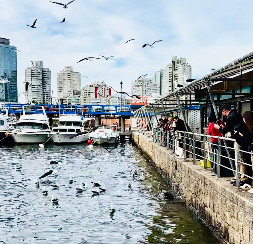
World Nomac on YouTube · The video waits until you tap play to load.
Whales, from the Austral seas, arrive very close to the shores of Punta del Este between July and November every year.
Before you go
The wider map holds more places to visit in Punta del Este than a day can cover. The undulating bridge at La Barra appears in the day-tour listings as a photo stop, and the Jose Ignacio lighthouse is named by the tourism ministry among the shore points for watching whales.39 Both lie east of the peninsula, in districts the resort grew into.38
Wine is the newest reason to leave the beach. A sommelier-led session of 4 Uruguayan bottles in town, lasting 2 hours, starts from $65 per person, and a private winery trip of 4.5 to 5 hours with a 45 minute drive starts from $199 for the group. Horse riding near Piriapolis is listed privately from $120, though its rating in our feed is low, so check recent reviews before booking.
For food, the English leaflet describes the typical grilled meat and a wide variety of seafood prepared on the coast.45 The sea itself is the best attraction on a hot day: the stretch of coast suits swimming and water sports, and the Intendencia keeps a list of beaches with services for the summer. Combine a beach, a sight and a meal and you have a full day.
For a day on the peninsula, begin at the lighthouse, walk the Rambla to the port, then cross to Gorlero for lunch and a look at the crafts fair. Move to Playa Brava for the Hand in the afternoon and finish at Punta Ballena for the sunset. The day tour from Montevideo follows almost the same route and keeps a long free stretch, 2.75 hours, for the town.
When it rains, switch to the Ralli Museum, the Azotea de Haedo or a wine tasting,26,20 and keep the beaches for later. Indoor stops can be strung together in a wet afternoon, as long as you check each opening time first. The Rocha station record shows rain in every month of the year, with April the wettest at 148 mm,46 so a flexible plan is a good idea whatever the season.
In the cooler months the resort slows down. The Intendencia says winter is the season of least activity of the year,47 and describes autumn as pleasant by day and cool at night and ideal for walks, fishing and visits to hills and ranches.48,49 Boat trips and the beach cafe on Isla Gorriti are tied to the summer months, so check what runs before you plan around them.25 In shoulder months the lighthouse walk, the museums and the wine tastings still work, and the sunset at Punta Ballena needs only a jacket.
FAQ
The Intendencia calls it one of the most visited places for photographs on Playa Brava.11
Per the ministry, southern right whales are present from July through October.5
The Intendencia lists it as a daily visit, 2 km off the port of the resort.4
The site's listing names the Casapueblo museum for 35 minutes.
The Intendencia describes 15 hectares, play areas and free access all year.22
It operates at the Playa Mansa end of the Rambla, stop 1, as a visitor centre.18
Sources
Also worth reading
Heading to Punta del Este? Ask a real person here.